Saturday, April 27, 2024


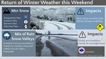
SPOKANE - A pattern change will bring much colder temperatures and lowering snow levels to the Inland Northwest starting Friday night. This will result in heavy snow and difficult travel conditions over mountain passes through early next week.
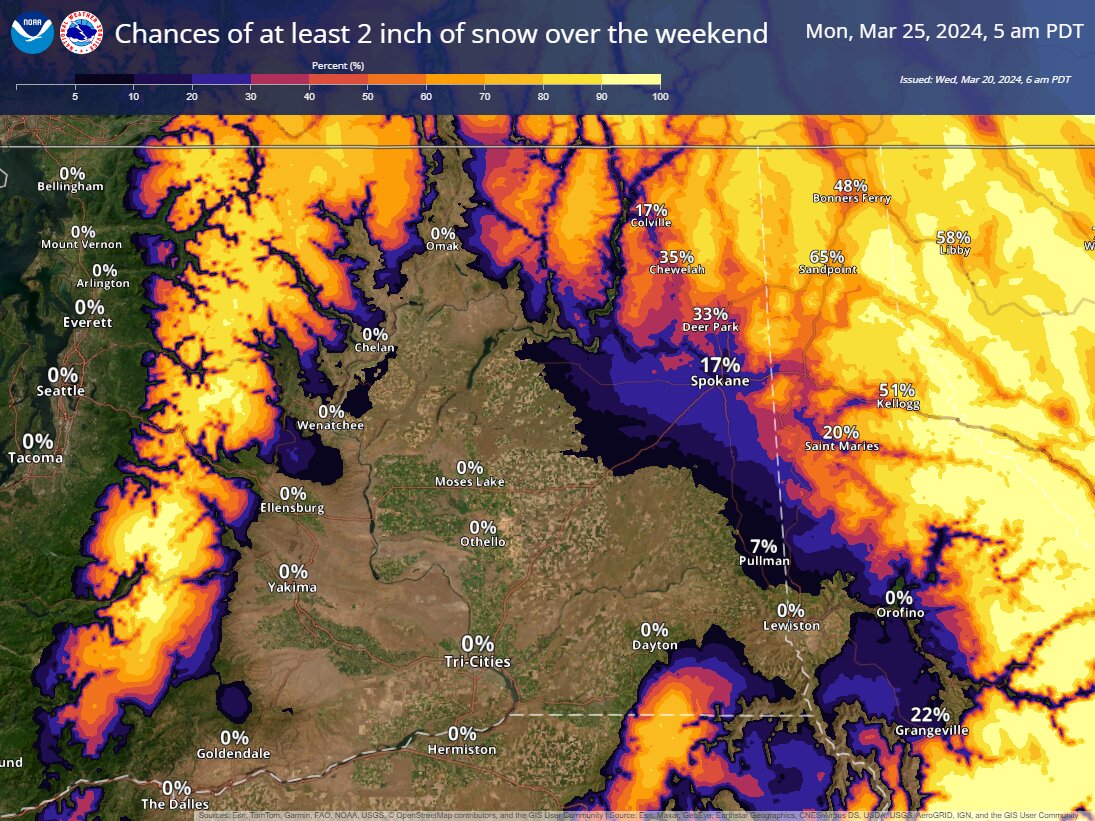
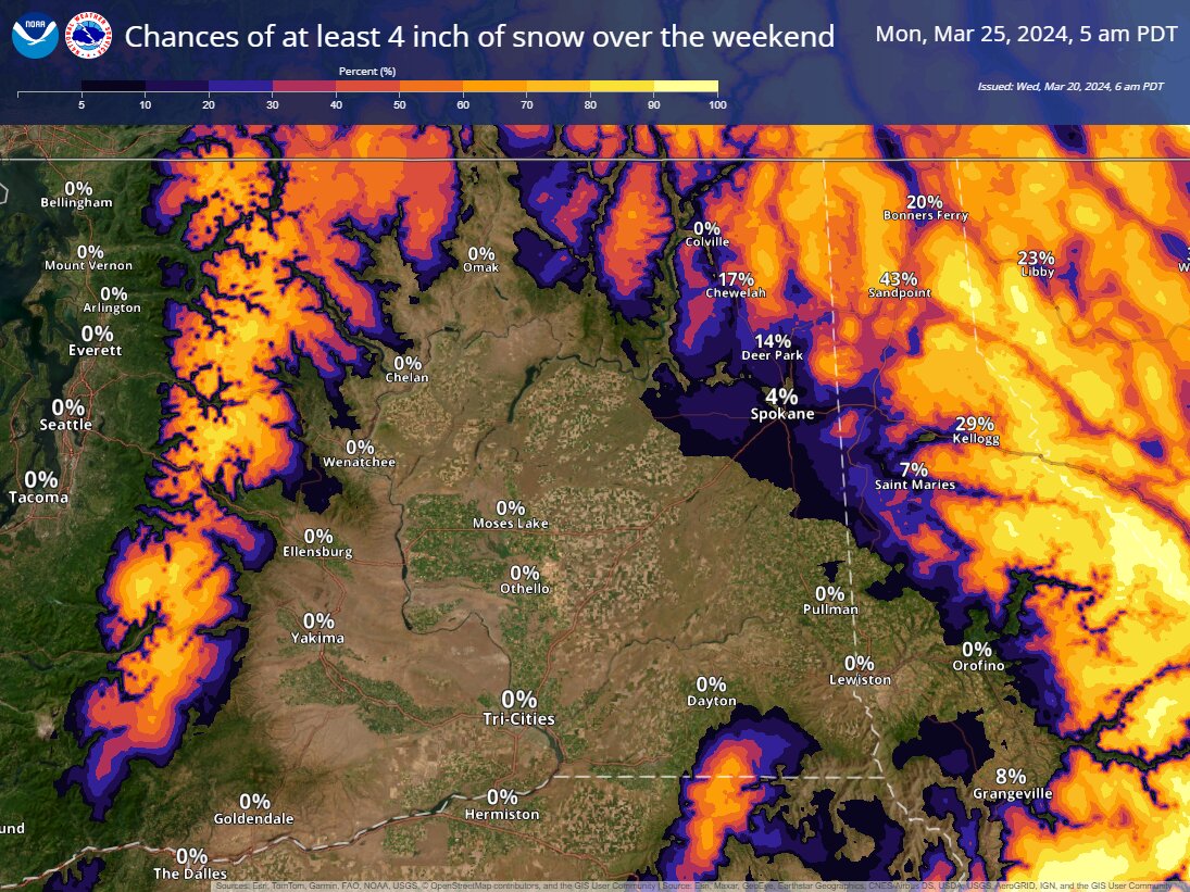
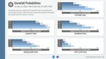
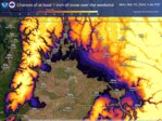
The National Weather Service office in Spokane is forecasting moderate to heavy snow accumulations over Washington's Cascade passes and mountain passes in Idaho from Saturday through Monday morning. Snowfall rates could reach 1-2 inches per hour at times.
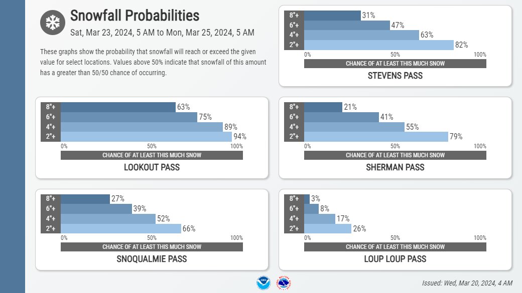
The heaviest snow is expected Saturday night into Sunday, when 6 inches or more of new accumulation is possible over Snoqualmie, Stevens, Blewett, Loup Loup and other high mountain passes.
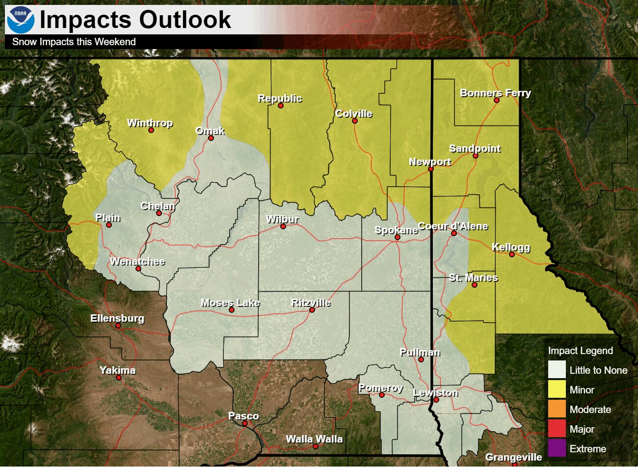
Snow levels are predicted to drop below pass level Saturday, allowing snow to accumulate on all mountain roadways. This could create very difficult driving conditions with low visibility at times.
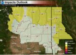
The Weather Service says they have high confidence in this winter storm impacting mountain travel this weekend into early next week. Steady snow looks to continue through at least Monday morning.
This multi-day winter storm will be a stark pattern change from the relatively mild and dry weather the region has seen recently. Impacts could be high with the potential for over a half foot of new snow over some mountain passes.


Comments
No comments on this item Please log in to comment by clicking here